Sometimes I like to take a trip via google maps. It usually ends up scaring me. Lately I’ve been specifically inspired by True Detective‘s fourth season, Night Country, to look for remote and northern destinations to drop my yellow person down into (if the van has been there, that is).
Anyway. Let’s say I accidentally teleported myself, my essentials (not food though), and a working vehicle into Red Lake, a little town quite a ways west from, let’s say, Niagara Falls Ontario, which is not where I live, but is not excruciatingly far. Red Lake has a nice-looking lake, a harbour called “Government Docks” which looks like a nice place to walk around by, and a restaurant called Antonio’s which appears to have one vegan option (spaghetti with tomato sauce).

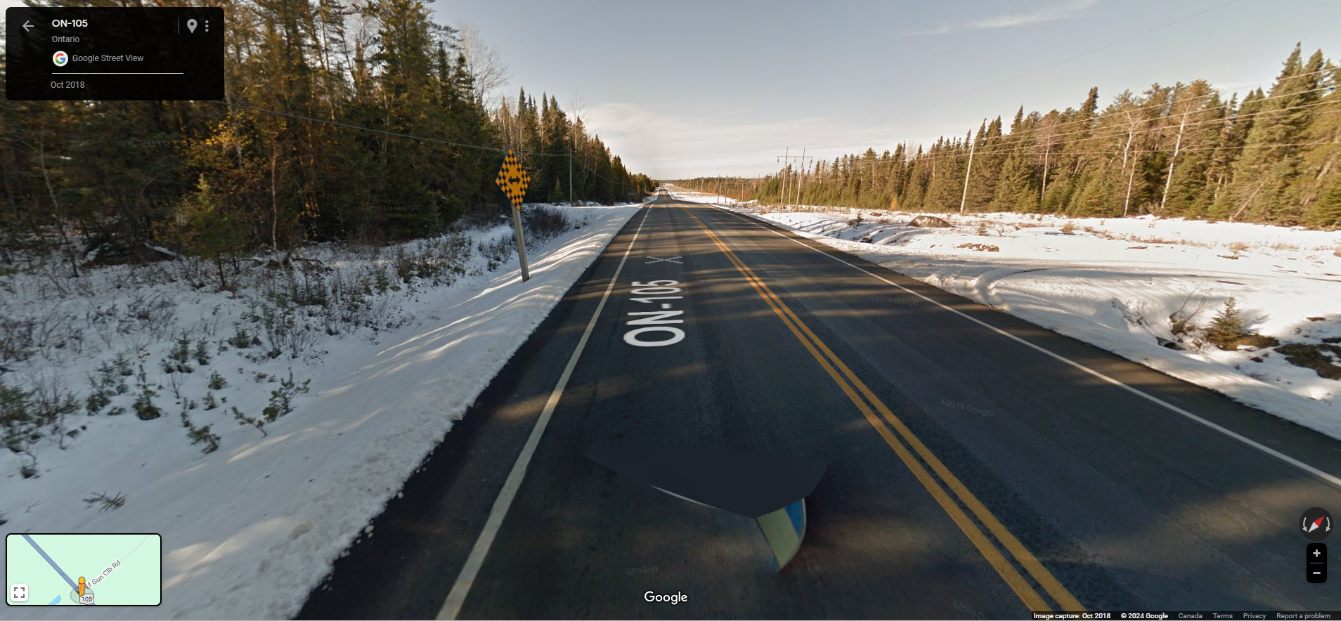
I put the yellow person right there on the road close to the lake and was rewarded with a nice image of the sun, and a bunch of snow. I would like to drive on this road. Not in extreme weather though.
So if I want to go home, I’ll have to head east and south. I’ll take the 105.
These long two-lane highways bookended by trees are pretty much what I expect driving in most places in this country. I can stop at Ear Falls. They have a beach, and Lac Seul Generating Station, and a splash pad, which I’m sure isn’t operational in February.
A million years later, there’s an intersection with 17 which is going to get me to 11 which is (part of) the trans Canada highway. At that intersection is Bobby’s Moose Creek Trading Post, which a reviewer didn’t like because there were no local or Indigenous goods, no public bathroom, and it wasn’t dog friendly (sad!). I don’t have a dog with me but I’ll skip.
At this point I’m thinking about when I might be able to have another meal. Not since the plain tomato sauce spaghetti have I seen a restaurant with a vegan option. To be fair, I’ve seen a Subway, but they barely have vegan options and even if they did, I wouldn’t do it. I also haven’t been looking hard, but, I think I’m right.

There’s something called “Eagle Lake Floating Vacations” but it says it’s a fishing camp, so I’ll just drive by.
Now there is Dryden, a bigger town that the van bothered driving through. There used to be a restaurant there, Kokom’s Bannock Shack, that apparently had vegan options and is now closed, which is very sad.
They have a Service Ontario if I want to go stand in a line. They have a tourist attraction called Max the Moose with 136 reviews, mostly positive. There is one 1 star review: “Its a moose… that got his balls cut off cause people couldnt stop playing with them.” I can’t vouch for that but that’s bleak if true.
There are many pictures featuring Max the Moose. I suggest you take a look. My personal favourites are the black and white artsy one where Max is looking to the sky, and also the one with the majestic rottweiler lying in front of Max. My canon is that this rottweiler was the dog denied service at Bobby’s Moose Creek Trading. I’m glad they got to enjoy Max at least.
I wanted a nice picturesque image of Dryden so I went for the street view on the little bridge, and I got this.

I wanted to know what that was, so I took a quick peak. It’s Dryden Fibre (paper towels, tissue, and paper). The first google review says, “Company responsible for dumping 9,000 kilograms (20,000 lb) of mercury into the English-Wabigoon River upstream of Grassy Narrows First Nation and poisoning the community, making it “one of Canada’s worst environmental disasters”. The company is all about profit, not caring for people. All the google reviews giving 5 stars are also probably bought off $$” – I don’t know about that either but will do some googling when I get home. [EDIT: soooooooo yes, this company is responsible for dumping mercury into a river and poisoning people from the Grassy Narrows and the Whitedog Indigenous nations and their water and fish. Link to a report on the situation and how it was handled, and the aftermath, with a focus on the community affected. Infuriating. Then there’s this too, about how the former owners, who are responsible for the poisoning, were let off the hook. And this, about the government deciding not to clean it up. And this, about how scientists recommended back then and again recently that cleanup was possible if costly, and could save lives. And this, about how the government is failing to help community members with health effects from mercury poisoning. Despicable, but honestly -93839337829338 star review to all the Ontario governments past and present too. Absolute trash.]
Now passing through Aaron Provincial Park. I doubt I’m in any shape for a hike but I’m going to risk it. The pictures people have posted look pretty great.
Now reaching Ignace, with a skate park and community garden, and a lake nearby.
At the time of this blog writing, just before cute little Hay Lake, there is a tourist attraction on the side of 17 called “Kelsie & Scotts Inukshuk”:

If that’s it, it appears to have fallen over. RIP.
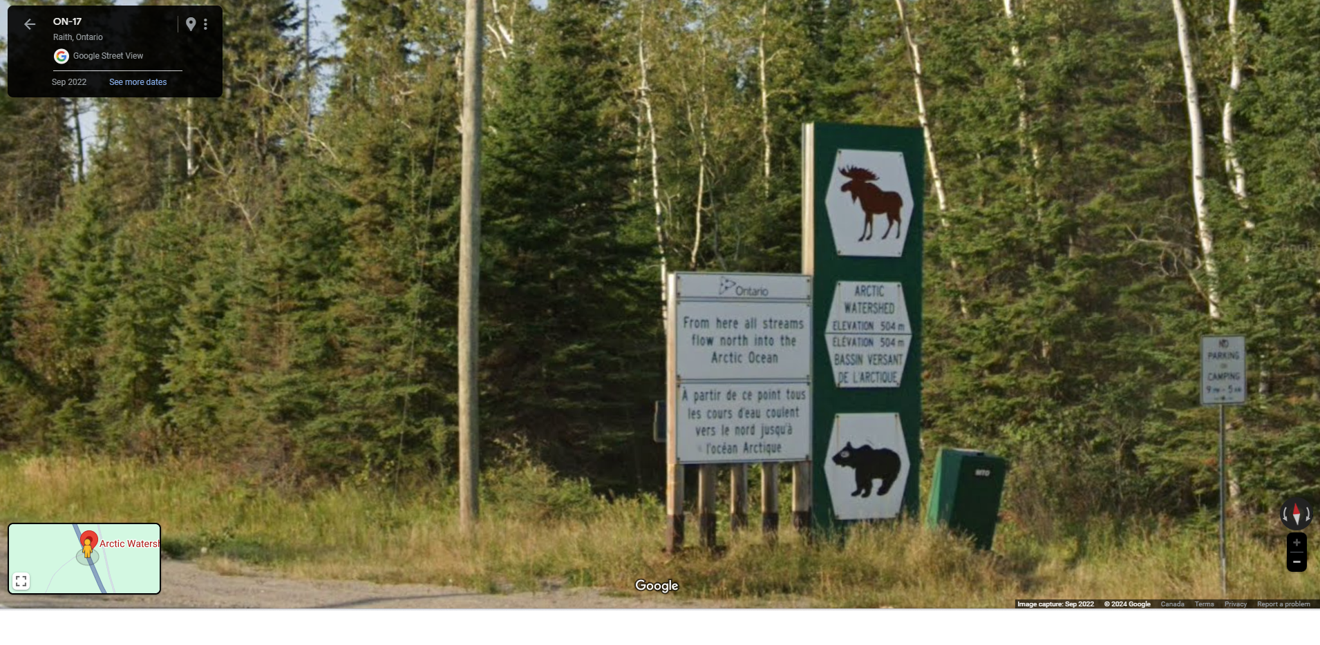
Next, past some more vegan-unfriendly restaurants and campgrounds, there is the Arctic Watershed Marker, and I’d like to stop and read that if I’m not being tailgated.
Finally we reach the 11. It’s here that I went “omg how long is this going to be still.” And zoomed out. And. Yeah. In a careers class in grade 8, I was assigned the trucker career. I sometimes think about what life would be like if I had pursued that, but I think now it’s clear I lack the necessary patience along with the stamina.
So. I think a realistic goal for now is to just get to Thunder Bay, which is a city with a few vegan-friendly restaurants so I can maybe finally eat.
Along the way, I’ll pass by The Barn which appears to be a place you can water your horses. Then there’s a cool-looking river but it appears you don’t see it from the road until you cross a little bridge. At this point I noticed that the highway I’m on is alternatively marked 11 or 17. That must be why it’s a two-lane-on-each-side highway now.
There is a rest area where someone has posted a picture of a dog with some sort of orange thing in their mouth. The reviewer approves of this rest stop. It must be dog-friendly.
Suddenly I’ve reached Kakabeka Falls, and I must stop and take a look. The view from the little bridge over the river isn’t much, but people have posted some beautiful pictures of the actual falls on google. My personal favourite includes an extremely fluffy dog.
Moving right along, I go over Jelly Road which is Wing Road on the other side of 11/17, interesting. A little while later, boom. Thunder Bay.
After stopping myself from starving to death at Bonobo’s Foods (I’d order the Crabby Bonobo. I cannot resist vegan crab-type foods), I probably want to check out several places, including but not limited to:
- the Thunder Bay Art Gallery (currently exhibits are Radical Stitch, about beading, and Wall Pockets, about beaded wall pockets and I am delighted because I love beads and I feel I need many wall pockets and didn’t realize those ever existed until now)
- Centennial Conservatory (the word “arboretum” appears and I must go)
- the Service Ontario (jk)
- omg does Subway pay google to highlight their sub-par food on the map, seriously, I’m not going to Subway ever
- Hillcrest Park (you can get a view of the city from up high there, looks pretty cool)
- Mario’s Bowl (I suck at bowling but whatever, I’ve always wanted to be that eccentric person whipping bowling balls down a lane all on their own, grooving to whatever music is playing)
- Thunder Bay Museum (I like the red velvet people playing instruments the most)
- I’d go to the Boreal Museum too but it appears to be closed for the off-season
- and I might try to visit the Clean Kitchen Coach because I could use some pointers.
Anyway. I realized now that Thunder Bay is right on Lake Superior and I lost my little mind. I have ALWAYS wanted to see Lake Superior which has ALWAYS been the scariest and most existential-crisis-inducing of all of the lakes. The Mission Marsh Conservation Area is on the shore and I’d go spend my life there, so looks like a good place to stop for now.
Some stats:
- just the driving on this trip is somewhere around 6.5 hours, which obviously doesn’t take into account reading highway signs, looking at fallen-over inukshuks, going for random hikes because I can’t resist a conservation area, looking at dogs at dog-friendly and dog-unfriendly places, and looking unsuccessfully for vegan food and finding mostly Subways, sporting goods stores, campgrounds, curling clubs, trees, and so on.
- If I wanted to walk it, and let’s face it, I do, it would be 119 hours, and google warns me that Thunder Bay is in a different time zone from Red Lake.
- There is no transit available for this trip. This makes sense, but I feel that if people in Red Lake want to go to Thunder Bay they shouldn’t have to rely on a car, or a 119 hour walk.
- The trip, now that I’ve reached Thunder Bay, is not even halfway done.
Maybe I’ll finish this trip later. For now I’m hanging with the goddess Lake Superior, peering into her depths and wondering about the nature of life, death, existence itself, and the deep, deep, darkness.
See you next time!